About Tenerife Topo Maps
+++ New GPS Mapping App +++ Easy to use Outdoor/Offline GPS navigation app with access to the best topographic maps and aerial images for Teneriffa. ++ For offline use PRO features needed ! ++ Turn your Andoid Phone/T
+++ New GPS Mapping App +++
Easy to use Outdoor/Offline GPS navigation app with access to the best topographic maps and aerial images for Teneriffa.
++ For offline use PRO features needed ! ++
Turn your Andoid Phone/Tablet into an outdoor GPS for trips into the backcountry WITHOUT CELL COVERAGE. This app gives you similar mapping options as you might know from Garmin or Magellan GPS handhelds.
Included FREE map layers:
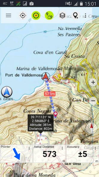
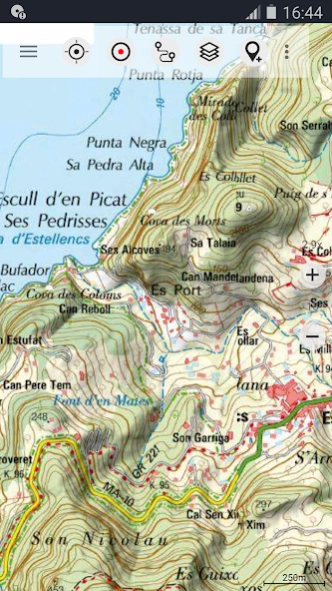
• Tenerife Topo Map: Mapa Topográfico Nacional 1:50.000 & 1:25.000 (IGN MTN25 & MTN50)
• Tenerife Base Map: IGN Base Topográfica Nacional 1:25.000 (BTN25 & BCN25)
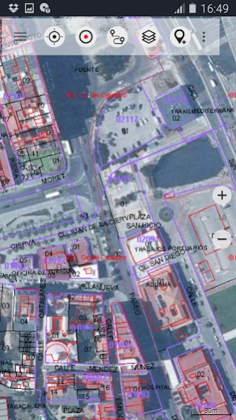
• Tenerife Imagery: High resolution aerial imagery. Plan Nacional de Ortofotografía Aérea (PNOA)
• Land Register Map: Cartografía Catastral
• OpenStreetMaps : These crowdsourced maps are a very useful addition to other map layers. Contains many unique features.
• OpenCycleMaps: These maps are ideal to plan bicycle trips
• ESRI Topographic
• ESRI Aerial Images
• ESRI Street Map
• Google Road Map (online access only)
• Google Satellite Images (online access only)
• Google Terrain Map (online access only)
• Bing Road Map (online access only)
• Bing Satellite Images (online access only)
• Earth At Night
• Hillshading overlay
Main features for outdoor-navigation:
• Create and edit Waypoints
• GoTo-Waypoint-Navigation
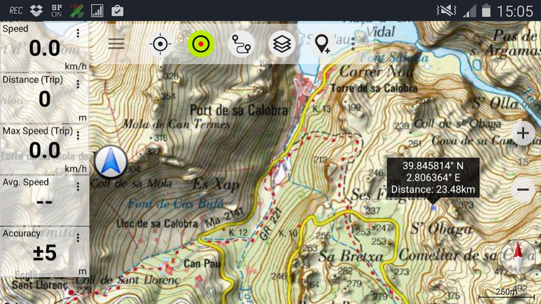
• Track Recording (with speed, elevation and accuracy profile)
• Tripmaster with fields for odometer, average speed, bearing, elevation, etc.
• GPX/KML/KMZ Export
• Search (placenames, POIs, streets)
• Customizable datafields in Map View and Tripmaster (e.g. Speed, Distance, Compass, ...)
• Share Waypoints, Tracks or Routes (via eMail, Whatsapp, Dropbox, Facebook, ..)
• Display coordinates in Lat/Lon, UTM or MGRS/USNG (Military Grid/ US National Grid)
• Record & share tracks with statistics & elevation profile
• Rotate map (Track Up & North Up)
• Get Elevation by long click on map
• Track Replay
• and many more ...
Available Pro features: (Pro features available via In App Purchase)
• Offline Use - no cell coverage needed
• Easy+Fast Bulk-download of map tiles for OFFLINE USAGE (not for Google and Bing maps)
• Create and edit Routes
• Route-Navigation (Point-to-Point Navigation)
• GPX/KML/KMZ Import
• unlimited Waypoints & Tracks
• Add other Map Tile-Server
• No Ads
Offline Use:
All viewed map tiles are kept in cache. To cache large areas you need to purchase Pro features.
Use this navigation app for outdoor activities like hiking, biking, camping, climbing, riding, skiing, canoeing, hunting, offroad 4WD tours or search&rescue (SAR).
Add custom waypoints in longitude/latitude, UTM or MGRS/USNG format with WGS84 datum.
Import/Export/Share GPS-Waypoints/Tracks/Routes in GPX or Google Earth KML/KMZ format.
Preload FREE map data for areas without cell service (Pro feature !).
Comments and feature requests to
[email protected]
Have a look at our other outdoor navigation apps: https://play.google.com/store/search?q=atlogis
+++ We DO NOT track any user activities or collect any user data ! +++
Previous Versions
Here you can find the changelog of Tenerife Topo Maps since it was posted on our website on 2016-10-10 07:07:58.
The latest version is 7.2.2 and it was updated on 2024-03-29 09:55:18. See below the changes in each version.
Tenerife Topo Maps version 7.2.2
Updated At: 2024-03-18
Changes: ・Improvements & Fixes
Tenerife Topo Maps version 7.2.0
Updated At: 2024-01-11
Changes: ・Automatically stop track recordings at configured waypoints
・Improvements & Fixes
Tenerife Topo Maps version 7.1.0
Updated At: 2023-10-25
Changes: ・More precise measurements
・Support for Android 14
・App shortcuts
・Fixes
Tenerife Topo Maps version 7.0.4
Updated At: 2023-08-18
Changes: ・Added keyboard shortcuts to control the app with external keyboards or control devices like BarButtons
・Fixes
Tenerife Topo Maps version 7.0.3
Updated At: 2023-07-13
Changes: • Fixes
Tenerife Topo Maps version 7.0.0
Updated At: 2023-03-16
Tenerife Topo Maps version 6.0.3
Updated At: 2020-06-04
Changes: . MBTiles / Mapsforge maps
. Fixes
Tenerife Topo Maps version 6.0.0
Updated At: 2020-05-08
Changes: . Configure how Waypoints are displayed
. Improvements & Fixes
Tenerife Topo Maps version 2.6.2
Updated At: 2019-07-23
Changes: . Track recordings can be paused
. Support for track segments
. Improvements & Fixes
Tenerife Topo Maps version 1.6.0
Updated At: 2016-10-05
Changes: x Improvements & Fixes
Disclaimer
Official Google Play Link
We do not host Tenerife Topo Maps on our servers. We did not scan it for viruses, adware, spyware or other type of malware. This app is hosted by Google and passed their terms and conditions to be listed there. We recommend caution when installing it.
The Google Play link for Tenerife Topo Maps is provided to you by apps112.com without any warranties, representations or guarantees of any kind, so access it at your own risk.
If you have questions regarding this particular app contact the publisher directly. For questions about the functionalities of apps112.com contact us.